

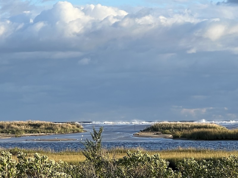
High tides and heavy winds created an ocean washover at Norton Point Beach late Friday.
High tides and heavy winds created an ocean washover at Norton Point Beach late Friday. A spokesman for The Trustees of Reservations confirmed early Saturday that there had not been a breach in the narrow barrier beach that runs from Katama to Chappaquiddick.
“No breach, but the bay is super high,” Darci Schofield, Islands director for the Trustees, told the Gazette in a text message. The Trustees manage the roughly two-mile stretch of beach.
“We ask visitors to avoid the flooded trails and driving into the edge of the dunes where water is present on the OSV trails,” Ms. Schofield said.
She said beach rangers are monitoring the conditions and will post updates on social media.
Breaches at Norton Point have been a subject for extensive scientific study through the years. The last time the beach breached was in April 2007 in a severe storm. The opening migrated eastward for years and finally closed in 2015.
More recently, the Trustees and the town of Edgartown have been involved in a coastal resiliency project at Norton Point that includes rebuilding dunes.
“Stormy conditions like these remind of the importance of continuing our coastal resiliency work,” Ms. Schofield said.
Comments
Why is there what appears to
Bill Stewart Hamden / EdgartownWhy is there what appears to be a breach in the photo? When the storm receded was the barrier intact? I have some great memories of the breach, but was unaware of its danger at that time.
Its about time we get serious
here we go again mvyIts about time we get serious about 'beach replenishment'. Get the Army corps of engineers to pump sand back on the beach. Its done all over the east coast except for here. When I grew up here the bunker was on the beach, and south beach was 100's of feet wide. Its a disgrace nothing has been done
Good idea - they should do
CalGood idea - they should do that at South Beach too.
Our beaches would be better
Danny East ChopOur beaches would be better off with a breach. The ponds bank sand from these storm events and then redistribute it over time during normal tidal movements.
When the oceans energy runs into a wall, it reflects that energy back out to sea, often taking the sand with it. This is why the entire south facing beach is so much steeper than it use to be.
“We ask visitors to avoid the
Mr. B Chilmark“We ask visitors to avoid the flooded trails and driving into the edge of the dunes where water is present on the OSV trails,” Ms. Schofield said.
Well, Mrs. Schofield, if you are concerned, why not prevent access for a few days until conditions improve? As a manager, that seems the productive and protective thing to do, even if it might irritate people who, having paid your fee, feel they have a right to drive all over the beach whenever they wish.
What a laugh and such
Jack ChappyWhat a laugh and such doublespeak …..what “coastal resiliency” work have the Trustees done? And when —- putting up rope fences or just shutting access down? I think it would be helpful if the Trustees stop pretending they are scientists or anywhere close to being “expert” in understanding or managing a fragile ecosystem like our blessed barrier beaches…..it reeks of deception.
Don’t forget that the name
Cynthia ChappyDon’t forget that the name Chappaquiddick means “sometimes an island“. Over the 71 years I have been on chappy we have been connected and not connected, and I seriously doubt dumping tons of sand will really make much of a difference. Maybe in the very short term but nothing more. With rising sea levels, mother nature will have her way.
Add new comment