

At a joint meeting held this week in Aquinnah, the board of selectmen and conservation commission unanimously endorsed two conservation restriction
The day was cold and clear at the old John Hoft Farm.
Vineyard Conservation Society's Rising Seas Awareness Project

In downtown Vineyard Haven, water could extend inland halfway to Main street, including the Steamship terminal, municipal parking lots and businesses. Both sides of Beach Road would be flooded, as would the Beach Road and Lagoon Pond Road commercial and industrial area.
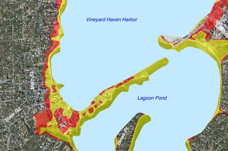
In downtown Vineyard Haven, water could extend inland halfway to Main street, including the Steamship terminal, municipal parking lots and businesses. Both sides of Beach Road would be flooded, as would the Beach Road and Lagoon Pond Road commercial and industrial area.
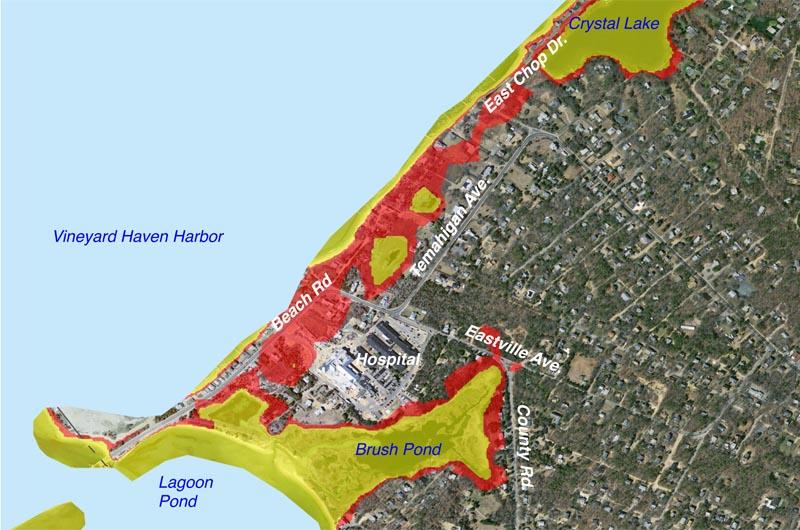
In Oak Bluffs, Important sections of Beach Road, Temahigan avenue, East Chop Drive, Eastville avenue and County Road could all be flooded, impacting hospital access.

In Oak Bluffs, Important sections of Beach Road, Temahigan avenue, East Chop Drive, Eastville avenue and County Road could all be flooded, impacting hospital access.
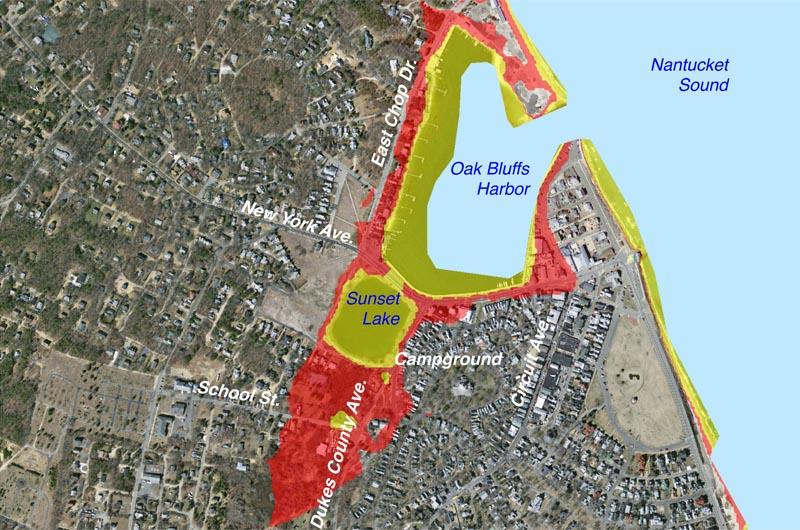
Around Oak Bluffs harbor, water would cross New York avenue and Sunset Lake, extending to south of School street and into the Camp Ground. Businesses between the harbor and Circuit avenue extension could be inundated.

Around Oak Bluffs harbor, water would cross New York avenue and Sunset Lake, extending to south of School street and into the Camp Ground. Businesses between the harbor and Circuit avenue extension could be inundated.

To the north of Farm Pond in Oak Bluffs, esidential areas and much of Waban Park could be inundated. Inundation could extend to the Farm Pond Preserve, into Harthaven and south of Hart's Harbor and Ice House Pond. .
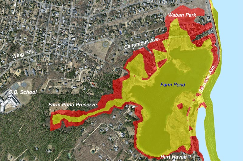
To the north of Farm Pond in Oak Bluffs, esidential areas and much of Waban Park could be inundated. Inundation could extend to the Farm Pond Preserve, into Harthaven and south of Hart's Harbor and Ice House Pond. .
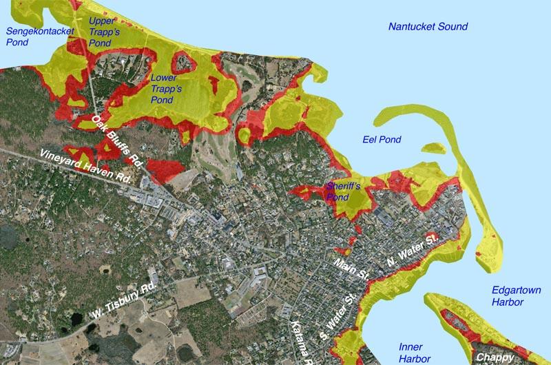
Downtown Edgartown’s harbor frontage could be inundated as far inland as North and South Water streets from Starbuck Neck to near Cooke street. The ocean's new shoreline would be on the island side of Sengekontacket Pond.
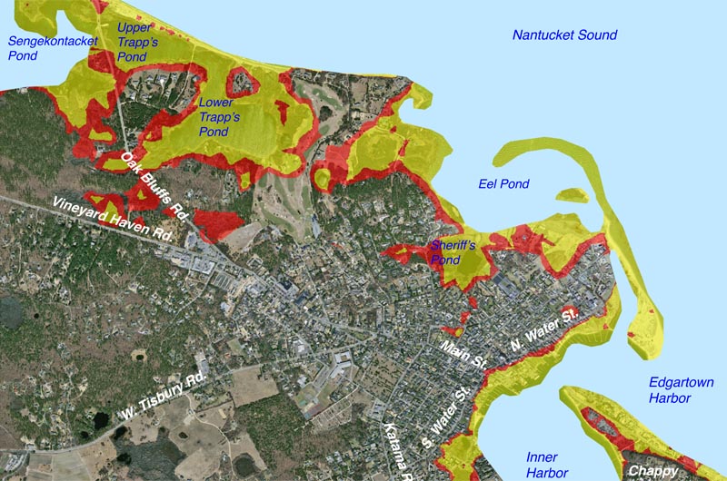
Downtown Edgartown’s harbor frontage could be inundated as far inland as North and South Water streets from Starbuck Neck to near Cooke street. The ocean's new shoreline would be on the island side of Sengekontacket Pond.

On Chappaquiddick, barrier beaches to the south and east would be relocated by predicted rising water levels and stronger ocean storms. Chappy Point, Gardner Beach and the On Time ferry terminals could be inundated.
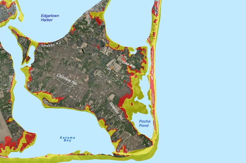
On Chappaquiddick, barrier beaches to the south and east would be relocated by predicted rising water levels and stronger ocean storms. Chappy Point, Gardner Beach and the On Time ferry terminals could be inundated.

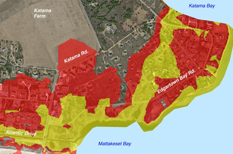
Edgartown’s frontage on Katama Bay and Mattakeset Bay is flat and low, and could be inundated shortly following the end of this century.
Edgartown’s frontage on Katama Bay and Mattakeset Bay is flat and low, and could be inundated shortly following the end of this century.

On the south shore, rising waters could flood present wetlands and push ponds inland. Dwellings and farm land are located within areas likely to be inundated.

On the south shore, rising waters could flood present wetlands and push ponds inland. Dwellings and farm land are located within areas likely to be inundated.

Menemsha Harbor’s docks bulkheads, roadways and utilities could be inundated by higher harbor water levels.
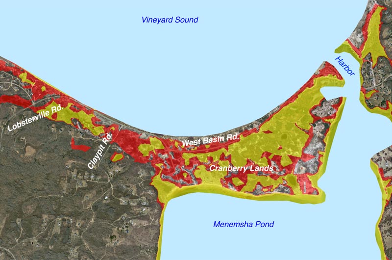
Menemsha Harbor’s docks bulkheads, roadways and utilities could be inundated by higher harbor water levels.
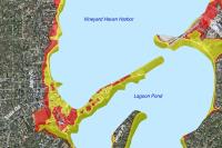
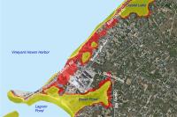
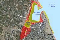


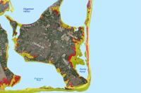
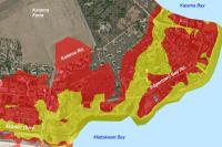
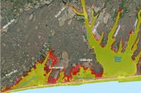
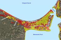
The following maps show the sea level rise on Martha’s Vineyard that is predicted based on the Intergovernmental Panel on Climate Change’s high forecast for greenhouse gas emissions and numerous other analyses.
These forecasts are also used for the state’s Climate Change Adaptation Report (2011) and the Martha's Vineyard Commission’s planning work.
• Areas shown in YELLOW on the maps would be flooded by a sea level increase of 1 meter (3 feet, 3 inches) — forecast to happen shortly after midcentury (2050 to 2070).
• Areas shown in RED would be inundated by an additional one meter of sea level rise, to a total of 6 feet, 7 inches — forecast to occur soon after the end of the century (2100 to 2120).
The maps do not show additional flooding that would result from high tides or storm surges/
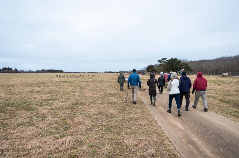
Walking Through Winter

Goat at Slough Farm.

Goat at Slough Farm.

Samantha Look of VCS points out where the group is starting.

Samantha Look of VCS points out where the group is starting.

Samantha Look speaks about the history of Herring Creek Farm.

Samantha Look speaks about the history of Herring Creek Farm.

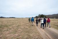
Walking through the field.

Walking through the field.

The large group startles some geese.

The large group startles some geese.


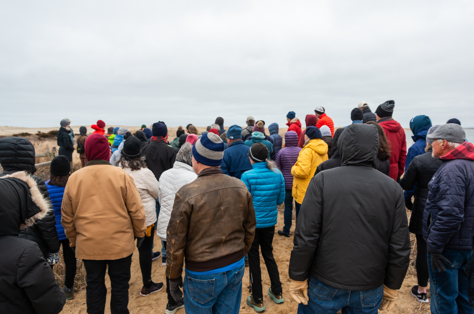
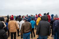
Emily Reddington speaks about the ecology of coastal ponds.

Emily Reddington speaks about the ecology of coastal ponds.

Pausing by Herring Creek.

Pausing by Herring Creek.


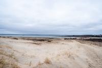
Edgartown Great Pond and Herring Creek.

Edgartown Great Pond and Herring Creek.

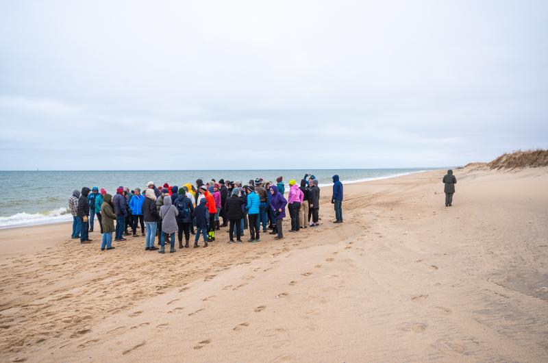
Walking toward South Beach.

Walking toward South Beach.

Ascending the dunes.

Ascending the dunes.

Heading toward the great pond opening.

Heading toward the great pond opening.


Marching back up the dunes.

Marching back up the dunes.


Herring Creek.

Herring Creek.

Highland cow at Slough Farm.

Highland cow at Slough Farm.


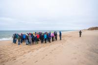


Attendees of the final Vineyard Conservation Society Winter Walk make their way from Slough Farm to Edgartown Great Pond and back in Katama. Guests Emily Reddington of The Great Pond Foundation and Ray Ewing of The Vineyard Gazette accompanied the walkers.