
How Martha's Vineyard Has Developed Over Five Decades

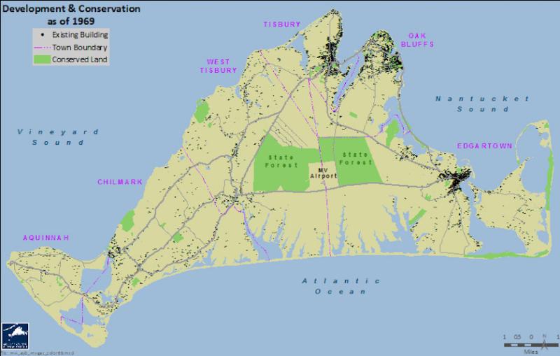
Map shows developed and conserved land in 1969.
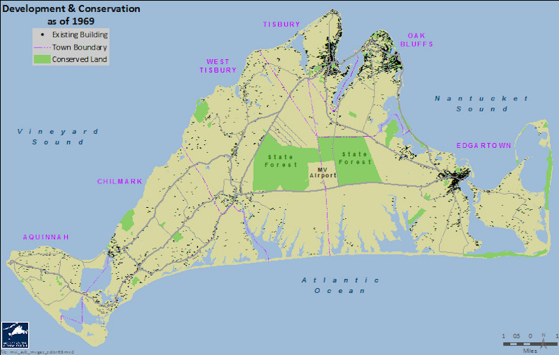
Map shows developed and conserved land in 1969.
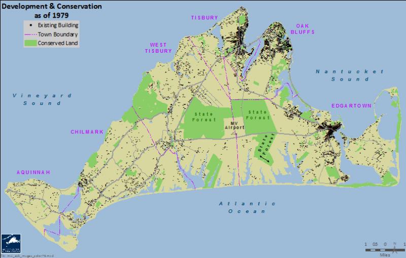
Map shows developed and conserved land in 1979.
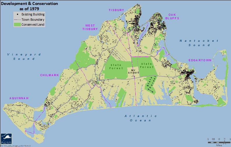
Map shows developed and conserved land in 1979.
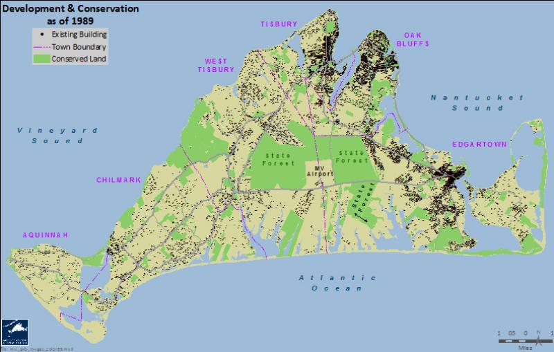
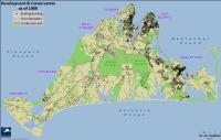
Map shows developed and conserved land in 1989
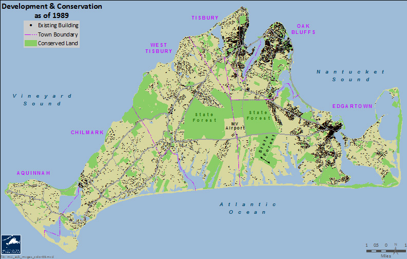
Map shows developed and conserved land in 1989

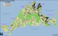
Map shows developed and conserved land in 1999.

Map shows developed and conserved land in 1999.

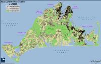
Map shows developed and conserved land in 2009.

Map shows developed and conserved land in 2009.
Map shows developed and conserved land in 2019.

Map shows developed and conserved land in 2019.

Maps show growth of development and conservation land on Martha's Vineyard over the last 50 years, from 1969 to 2019. Special thanks to cartographer Chris Seidel of the Martha's Vineyard Commission.