
Heavy Surf Closes Island Beaches to Swimming
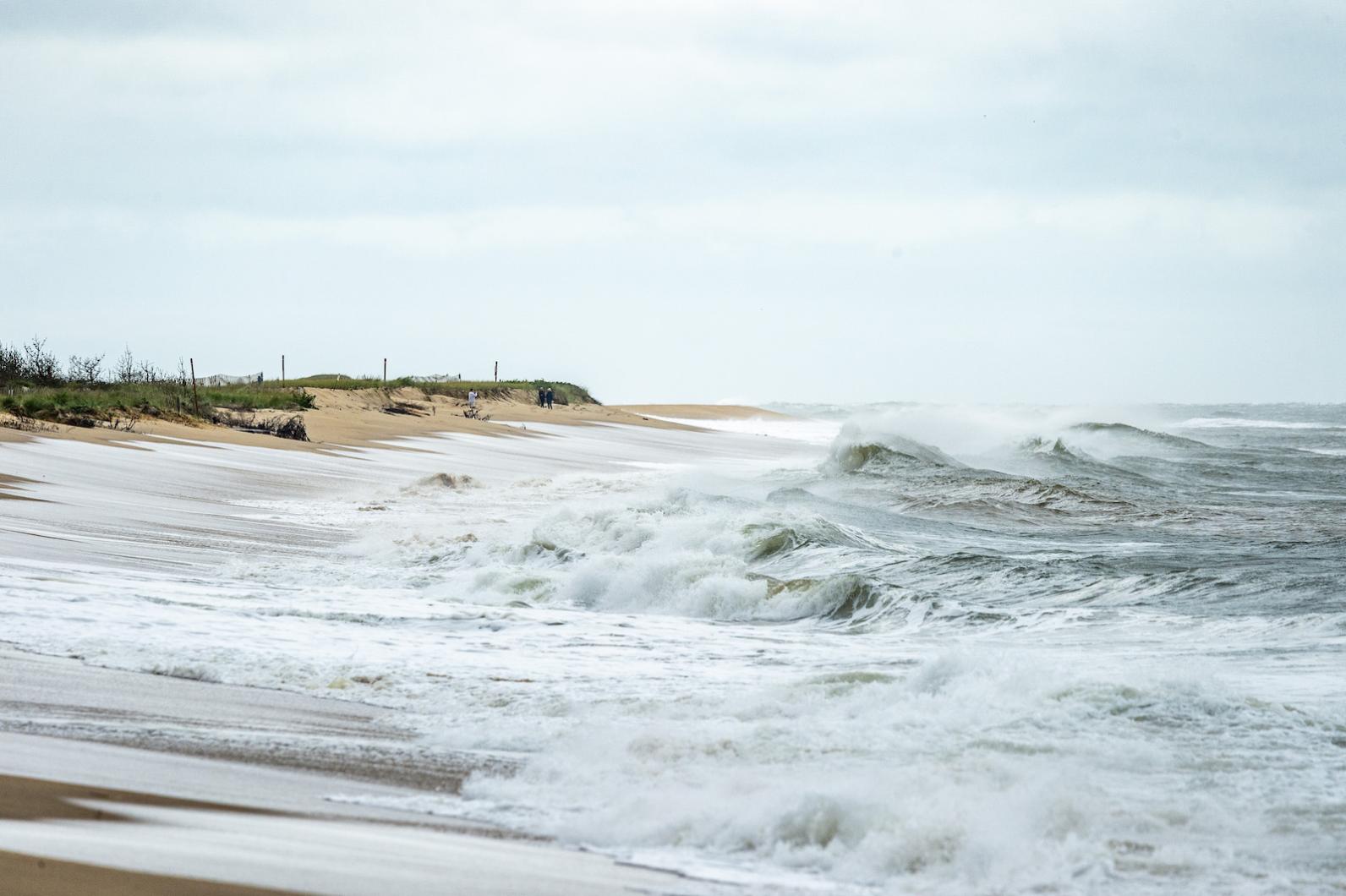
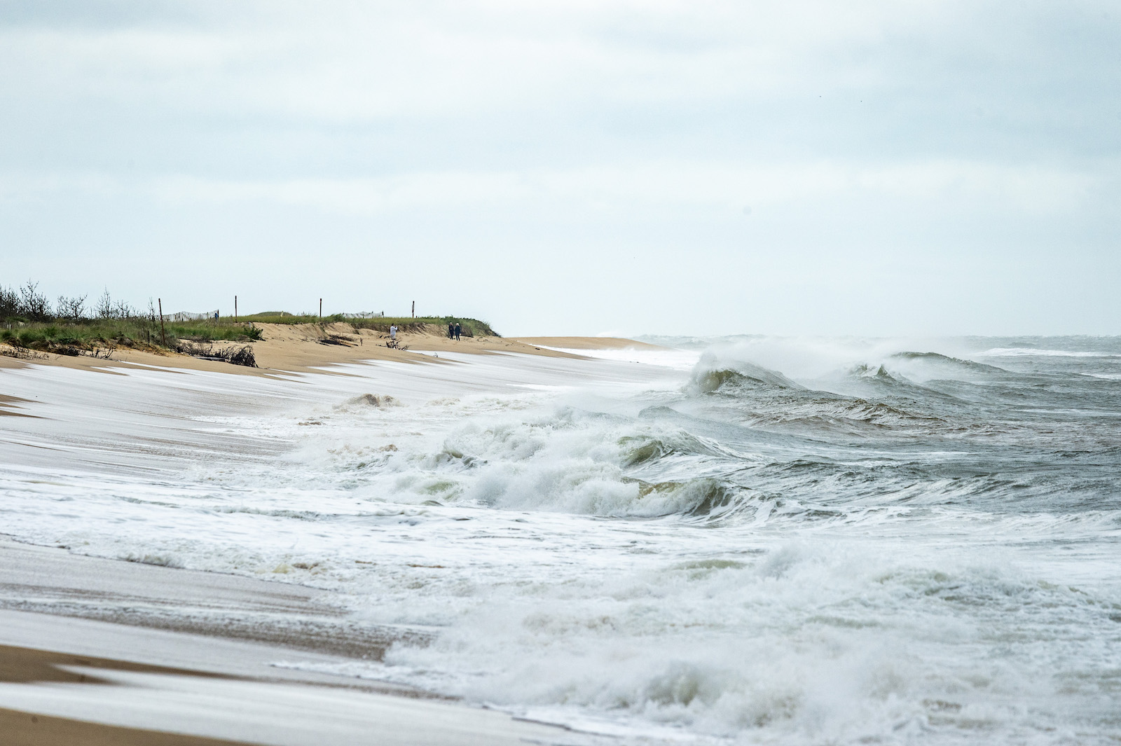
As Hurricane Erin moves north up the east coast, strong winds and heavy surf have closed beaches to swimming and caused ferry schedule changes.
As Hurricane Erin moves north up the east coast, strong winds and heavy surf have closed beaches to swimming and caused ferry schedule changes.

South Beach is closed to swimming.
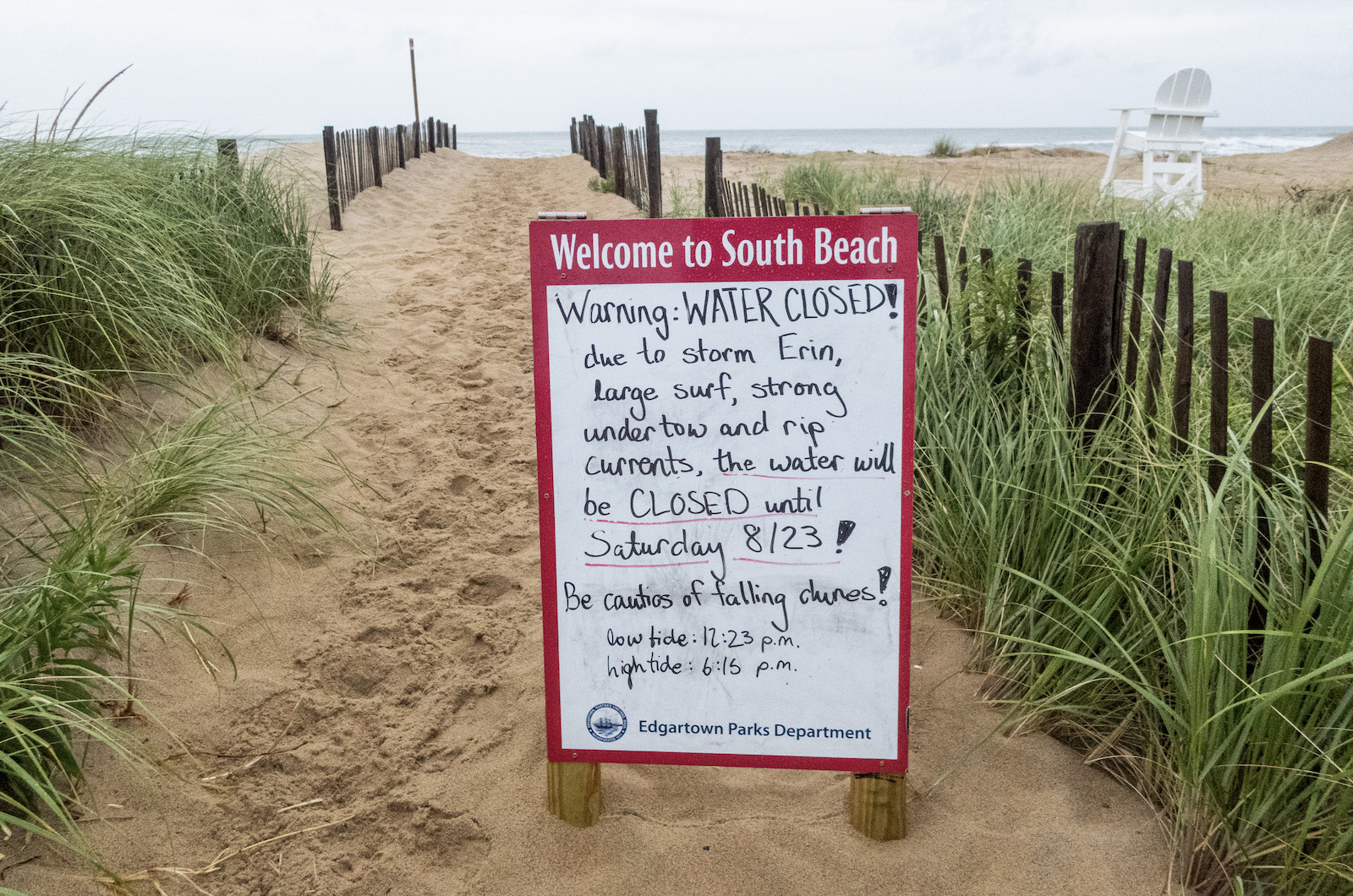
South Beach is closed to swimming.
Both Edgartown and the Trustees of Reservations have closed their beaches to swimming, and Island officials are keeping an eye on storm surges and erosion.
“I’m sitting here right now at right fork and I’m watching two rip currents form right in front of me…” said Andrew Kelly, an Edgartown parks commission member, who was patrolling South beach Thursday afternoon.
“[The] really experienced swimmers [who] are used to the conditions here, even they struggled a bit,” he said.
He asserted that the South Beach lifeguards went in the water Wednesday morning and struggled to swim through the currents.
The Dukes County Emergency Management Association is monitoring the Category 2 storm, which was off North Carolina Thursday. The storm is expected to move out to sea as the week progresses, though rip currents will be strong through the weekend.
Emergency officials recommend staying away from jetties, piers and other coastal structures.

Getting a glimpse of the waves.
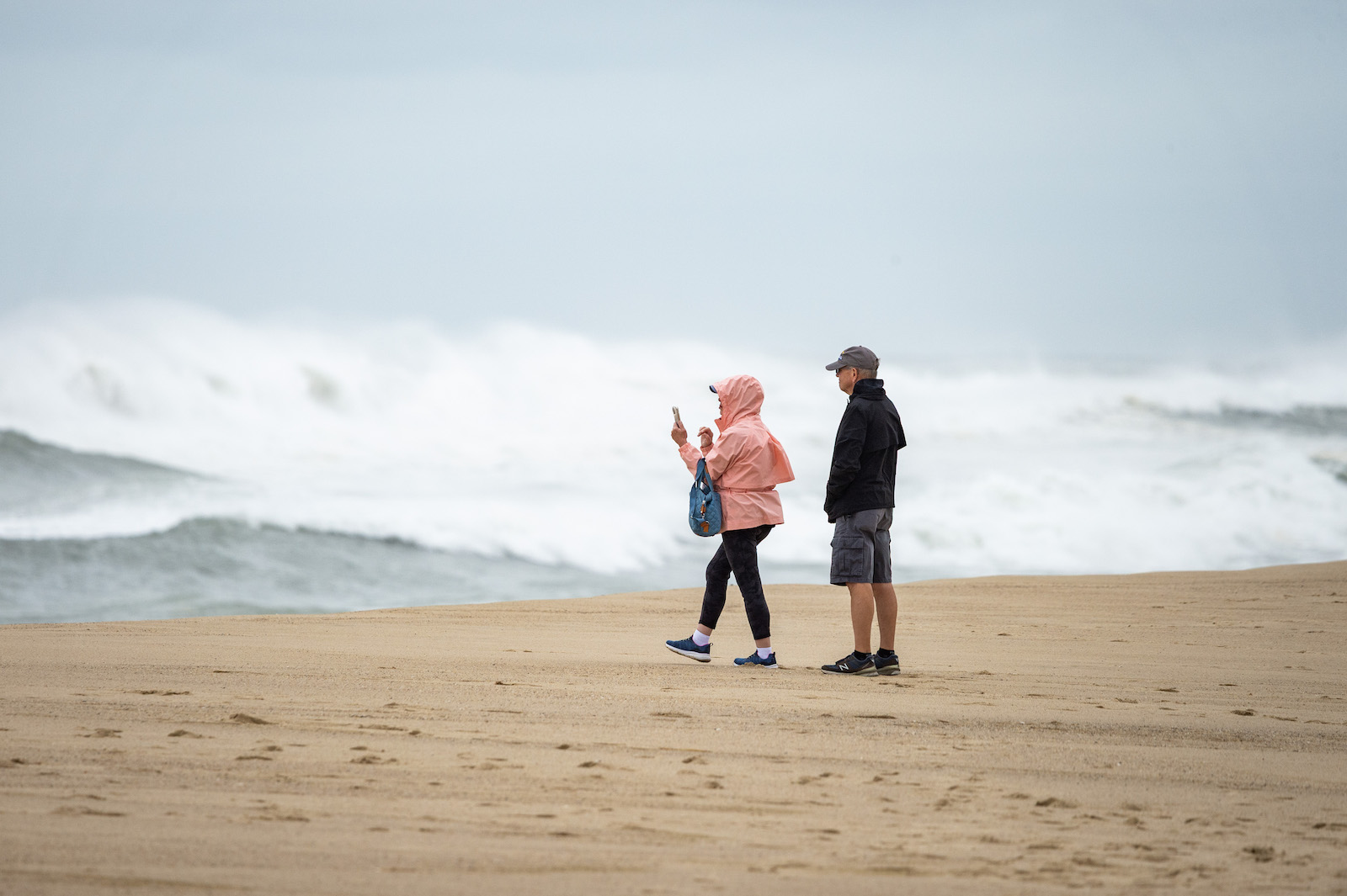
Getting a glimpse of the waves.
High surf advisories will remain in effect until Saturday across the Island. South shore beaches will be the most vulnerable, according to the association, which expects 10 to 15 foot breaking waves. A coastal flooding advisory will also be in effect until at least late Friday night.
The emergency management association recommends that beachgoers avoid entering the water in general and advises boaters to postpone trips.
The National Weather Service has put out a wind advisory for Dukes County through 2 p.m. on Friday. The agency predicts winds of up to 45 miles per hour coming from the northeast.
The storm is diverting some Steamship Authority ferry trips from Oak Bluffs to Vineyard Haven, a more enclosed port. The Steamship says the forecast indicates that diversions will continue through most of the day Friday; change and cancellation fees have been waived.
Several events planned for the week have been postponed. In Oak Bluffs, both Grand Illumination and the annual August fireworks were pushed back.
The fireworks will take place on Saturday. Grand Illumination is scheduled for Thursday night, and no traditional candles will be allowed due to the forecast of high winds.
The waves from the storm have brought some onlookers out to the beaches who want to see how their favorite spots are faring. In Edgartown, Mr. Kelly said the town was allowing people to walk up to the shore to view the waves, which were reaching up to eight feet tall on Thursday, but swimming is prohibited.

Illumination night was postponed to Thursday.

Illumination night was postponed to Thursday.
The stretch of South Beach between left and right fork has been narrow all year, and Mr. Kelly said he’s worried about Atlantic Drive. If the dune is lost, he said the town will have to reconstruct it in the off-season.
“It’s starting to really take a beating over there,” Mr. Kelly said.
State Beach is getting the brunt of the wind, Mr. Kelly said, which is coming from the northeast. Gusts are expected to reach 45 miles per hour.
The town is keeping a close eye on Norton Point. He said there’s significant wash over in a portion that has breached before, and the town should be able to anticipate if a breach will occur Friday morning.
“If that breaches, it affects the tides and the currents in the harbor for everybody on the moorings too,” Mr. Kelly said.
The Dukes County Emergency Management Association’s Islandwide emergency alert system officers notifications in multiple languages. Sign up for notifications at dukescouty-ma.myfreealerts.com.
Comments
I think overall, despite some
John Aldeborgh KatamaI think overall, despite some erosion, we dodged a huge bullet, this storm developed very quickly and became a monster. Thankfully its track never made landfall in a populated area, passing by the Caribbean islands and the Eastern Seaboard as well as staying west of Bermuda. Let’s hope we stay lucky for the remainder of the hurricane season.
September and Norton point is
rob the roofer new jerseySeptember and Norton point is my target so far so good. Safe seas and shores to all.
Add new comment