
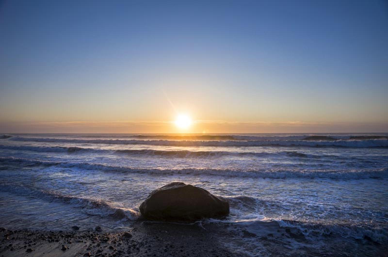

As leading state environmental officials look to the Island’s offshore resources to further wind energy goals and mine sand for beach fill, a small but vocal crowd of Vineyarders are airing their concerns about tapping these resources to the detriment of the fisheries and other sea life.
As leading state environmental officials look to the Island’s offshore resources to further wind energy goals and mine sand for beach fill, a small but vocal crowd of Vineyarders gathered at the Katharine Cornell Theatre Wednesday evening to air their concerns about tapping these resources to the detriment of the fisheries and other sea life.
Hosted by officials from the state office of Coastal Zone Management, the meeting was a public hearing on the draft Ocean Plan, a 200-page document that contains a wide-ranging set of plans, maps and regulations for state waters off the coast of Massachusetts. Its jurisdiction extends from 1,500 feet offshore to three miles, where federal waters begin, approximately an area of 2,145 square miles. The first plan was done in 2009; the new draft is an update and public comment is invited through Nov. 25.
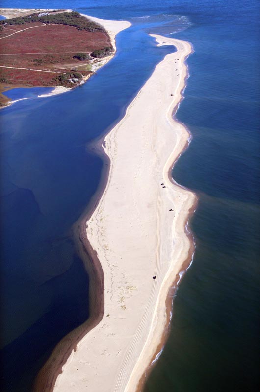
Among other things, the plan seeks to identify suitable spots for dredging offshore sand deposits. The plan maps a handful of locations, including a large area off the north shore of Martha’s Vineyard. These sites would host up to three pilot projects for public benefit in the next five years.
Many coastal communities in the commonwealth are experiencing erosion, as well as flooding and storm damage, explained Coastal Zone Management director Bruce Carlisle, and public beaches often bear the brunt of those impacts. He said some communities are looking for sand to replenish their beaches.
He said the sites for possible offshore dredging were identified through consultation with other state agencies and were determined to present the least impact on fisheries and ecosystem.
State looks to tap rich offshore resources; Islanders say not so fast.
State looks to tap rich offshore resources; Islanders say not so fast.
But Islanders who attended the meeting questioned the suitability of the chosen area off Aquinnah and Chilmark.
Shelley Edmundson, a Vineyard Haven resident and scientist with the University of New Hampshire, said she had concerns that sand mining would lead to habitat destruction and would conflict with conch fishing spots.
“I am very concerned about whelk habitat,” she said. “They prefer sand to muddy spots, and there you go, you’re sucking it up.”
Chilmark selectman Warren Doty echoed her comments, saying that a project to mine sand offshore conflicted with the founding principle of the Ocean Act: to preserve the health of the oceans.
“The health of the ocean demands that you don’t do sand mining,” Mr. Doty said. “We are not improving the health of the ocean by digging up the benthic environment.”
He said the area proposed for offshore sand mining was a rich fishery for the Vineyard. He added that the seabed was full of living things.
“You take a core sample of the top six or eight inches, you pick out 47 small or living things,” he said.
Some audience members spoke to the need for sand mining opportunities in beach nourishment projects.
One was Caroline Hunter, an Oak Bluffs resident and member of a citizen beach committee formed this past year.
“We support the mining of offshore sand with the potential of providing high-quality material that preserves the quality and safety of our beaches,” she said.
Mr. Carlisle said his agency would consider both the needs of communities affected by erosion and those concerned about the effects of sand extraction.
“I want to be clear, we are trying to provide a balance here, because we hear things from both sides. We hear people saying they want sand, and we hear others saying no way, no how, get out of town,” he said.
He said his agency was committed to working with the Division of Marine Fisheries, with their fisheries work group and with National Marine Fisheries Service, to examine the provisional areas.
“If there are still concerns or resources that are objectionable, those areas will be eliminated,” Mr. Carlisle said.
Another major focus of the revised Ocean Plan has been offshore wind power generation. The current draft identifies areas for the transmission of that energy through state waters. The plan draws on a study by the Massachusetts Clean Energy Center which looked at best practices for wind energy transmission, identifying the most convenient places to tie into the grid which have the least impact on fragile resources.
In June, state and local officials announced that an area 12 nautical miles south of the Vineyard would be open to commercial wind energy leases, but planning around the transmission of the energy from wind turbines to a shoreside converter has not been exhaustive.
“We do not want to be in this position where whatever projects materialize, the state is being reactive to whatever areas are being proposed by the developers,” Mr. Carlisle said. “We want to put some rational thinking around this.”
While the plan recommends certain areas for transmission corridors, it does not preclude a developer from taking a different route.
The Ocean Plan also gives the Martha’s Vineyard Commission legal authority to define the scale of wind projects.
Mr. Doty, who has been a member of a federal committee charged with evaluating resources and alternative energy uses on the ocean, expressed concern about the designated state areas for wind power development, which have been reduced to two commercial areas, both near Martha’s Vineyard.
“How is it that the only two places that the plan has identified for wind power is off of Aquinnah and Cuttyhunk — nothing happens anywhere else in the state,” he said. “We worked hard to . . . . keep them 12 miles south of the Island and in some cases 14 miles, and now we have a Massachusetts plan that
puts them within three miles,” he said, speaking of the work by the Bureau of Ocean Energy Management, an agency of the U.S. Department of the Interior.
The Ocean Plan is a mandate of the state Oceans Act of 2008 and it must be updated every five years. The current update involved the gathering of new scientific data to better define sensitive areas, including an area identified as sea duck habitat.
The protected area for those birds has grown dramatically since 2009, due in part to the advocacy of Vineyard birders who provided information about the various species of sea ducks and their preferred habitats.
“It’s very clear if you look at the before and after, what happens if we do trust in the process, and we do participate,” said Jo-Ann Taylor, a coastal planner with the MVC.
Ms. Taylor is one of 17 members of the Ocean Advisory Commission, which played a role in shaping the scope of the update and will meet Dec. 2 to discuss the final draft of the plan.
She said another meeting will be held for town officials and residents to discuss the issues with sand mining, probably in early November.
Comments on the 2014 draft ocean plan are due by 5 p.m. on Nov. 25. Written comments should be sent to the Massachusetts Office of Coastal Zone Management, ATTN: Ocean Plan, 251 Causeway Street, Suite 800, Boston, MA 02114. Comments can also be sent by email to [email protected].
Comments
It seems that we can all
Elizabeth Rose Georgetown, MAIt seems that we can all comment as much as we want but without some science to inform about the potential cost/benefits of farming sand offshore we are all just expressing our own biases. What is the effect on Whelk habitat? Why hasn't that information been part of the plan?
Among worrisome details in
tom hodgson wtAmong worrisome details in the report are the proposed fee levels, aka "environmental mitigation fees", for permits. See appendixes 6 and 7 for details. Want to do something that the State CZM considers to have "negligible" effects? As in "no perceptible impact"? OK, but first you'll have to write a check for between ten and almost fifty thousand dollars. Other "levels" of "permits" can cost you millions. These "environmental mitigation fees" are put in a new State Trust fund. There are good arguments for such an arrangement, but the thought of yet another self-serving Massachusetts bureaucracy is less than exciting. You can download the report from: http://www.mass.gov/eea/waste-mgnt-recycling/coasts-and-oceans/mass-oce…
There is a smaller download available, without maps.
The sand from the south shore
BG EdgThe sand from the south shore that has been eroded into the adjacent area should be pumped back onto the beach. Every other state in on the east coast does this and there is no reason we shouldn't. The army corps of engineers should be able to provide the necessary data to support this. Unless you just moved here, you will remember the days when South Beach extended hundreds of feet more than it is now in Edgartown, and the bunker sat on top of the sand. There is now nothing left. If you let 'nature take its course' then we lose the south shore of the Island.
There will be a south shore
GB WTThere will be a south shore of the Vineyard for years to come. It's just that with erosion progressing as it is, Edgartown/West Tis Road will have an ocean view similar to Seaview Ave in OB.
Now we know where the sand
Squibby lover ChilmarkNow we know where the sand for the Squibby dune is coming from. And the Army Corps of Engineers? The same folks who brought us the levees in the 9 th ward of New Orleans that did such a good job protecting folks from Katrina? Oh. What's the shelf life of the bird Cusinart/ windmills? Longer than the fake dunes.
You guys are so entertaining.
Danton ParisYou guys are so entertaining. Better than television. So self-righteous, so earnest, so sure you are right. The Island of the Certain.
Hey Danton. A little respect
Paulli D EdgartownHey Danton. A little respect of the people of MV and America. Remember Dan, you would be speaking German if not for some of the ancestors of the people of MV. Go back to your cheese.
Right on, Paulli
j bRight on, Paulli
Excellent point Paulli D!
BG EdgExcellent point Paulli D!
At the end of the day, Mother
Glenn R. St. Petersburg,FLAt the end of the day, Mother Nature will always have the last word on the distribution of sand. She will trump any and all decisions man makes on how much sand should be placed where. There will be an endless drain on tax dollars UNTIL THE END OF TIME. Once this Pandora's Box is opened, members of the various members of the chambers of commerce, and various landowners, will be hectoring constantly the elected officials to add sand to their beach. In other words, public funds will be used to benefit private land owners. Don't do this. Look what happened Pinellas County, Florida. "Beach Renourishment" turned out to be an ecological disaster there.
Add new comment